

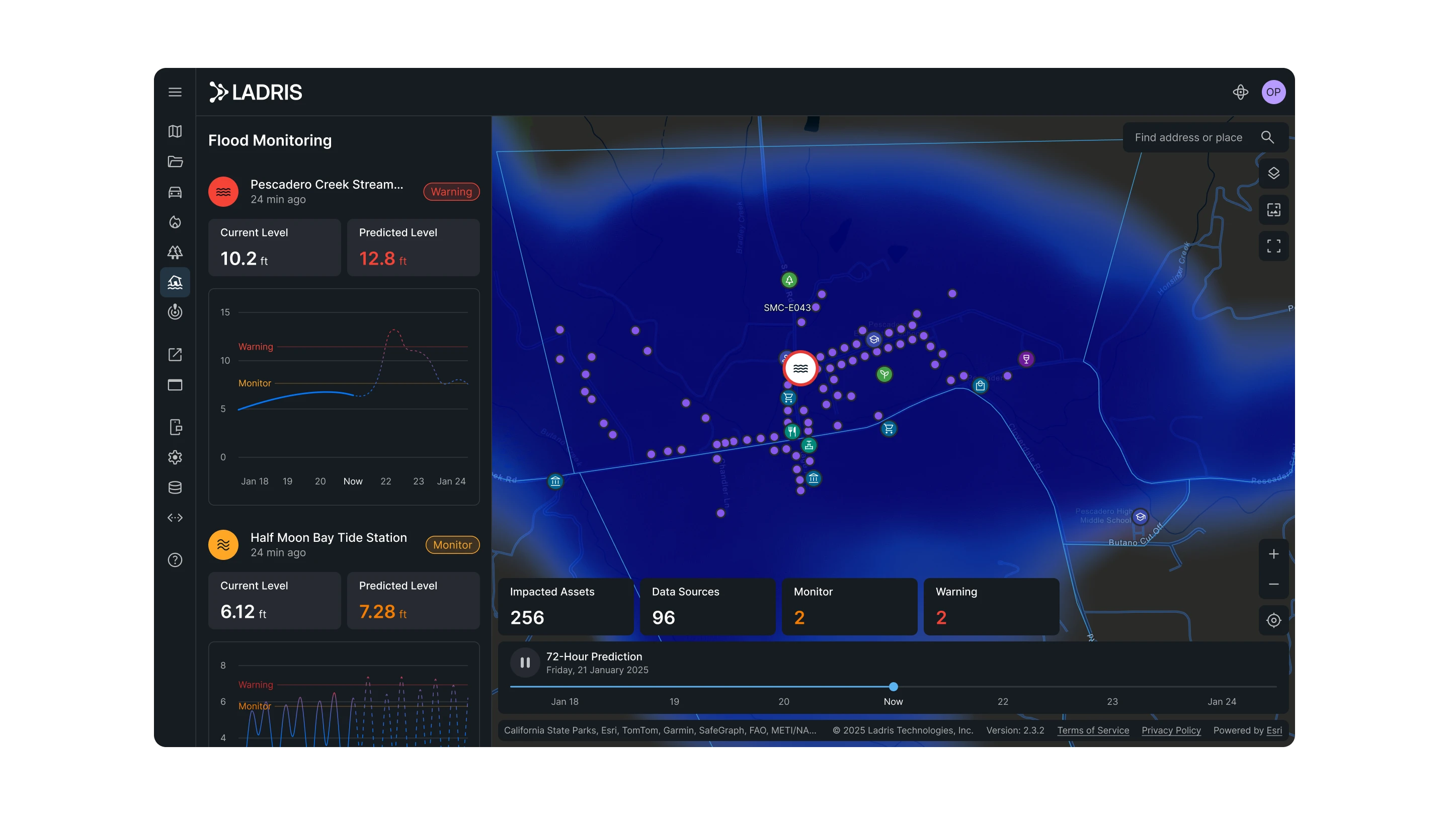


Dynamic Flood Forecasting for Real-World Decisions
Flood transforms traditional flood mapping into a continuously updated decision-support tool. Designed for emergency managers and infrastructure operators, it delivers geospatially precise forecasts powered by live environmental data and is built for the speed and complexity of real flooding events.
Forecasting
Forecasts Up to 72 Hours Ahead
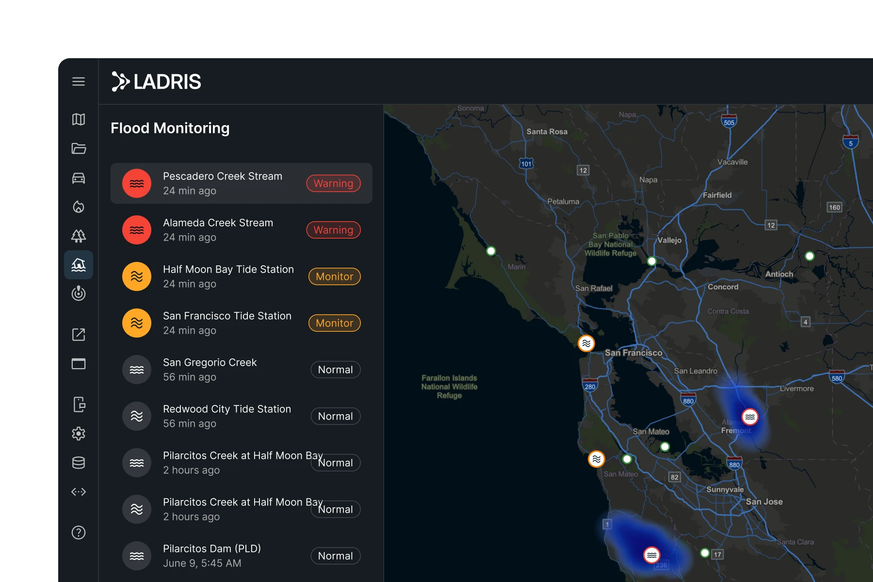
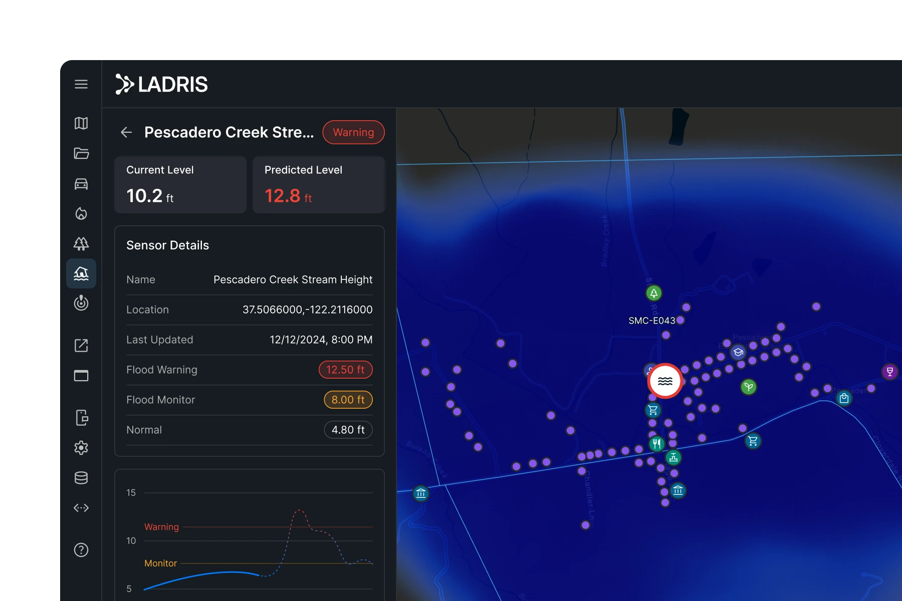
Generates high-resolution flood impact forecasts that update automatically as new data flows in from radar, gauges, and weather systems.
Live Data
Grounded in Real-Time Conditions
Integrated with USGS gauges and national weather radar, Flood draws from live water levels and precipitation trends — moving as fast as conditions do.
Evacuation Integration
Connected to Evacuation Planning
Connects with Evac to simulate how rising water levels affect evacuation zones, route accessibility, and clearance times.
Key Advantages
From the Storm to the Structure
Stay Ahead of the Waterline
Minute-by-minute forecast updates deliver a continuous picture of changing flood conditions, ensuring your team is always working from the most current information.
Precisely Identify At-Risk Assets
Move beyond broad risk zones. Flood pinpoints which buildings, roads, substations, and critical facilities are likely to be impacted based on real terrain and live forecasts — so resources go where the need is highest.
Keep the Field in Sync
Built for both desktop and mobile, Flood gives field teams and planners a shared, real-time view so decisions made in the EOC reflect what’s happening on the ground.


Built for Flood Response Teams and Infrastructure Planners
Flood supports the full lifecycle of flood readiness, from pre-storm planning to active incident response. It brings together the intelligence needed to protect communities and infrastructure in rapidly evolving flood scenarios.

Pre-Storm Planning
Identify high-risk areas, model inundation scenarios, and validate response plans before conditions develop.
Active Incident Response
Track evolving flood conditions in real time and adjust resource deployment as the situation changes.
Infrastructure Protection
Identify which critical facilities, roads, and utilities face the greatest exposure and prioritize protective actions accordingly.
© 2026 Ladris Technologies, Inc. All Rights Reserved.


