Products
Ladris Core Platform
Platform Overview
One platform for all your disaster decisions
Analytics
Put AI to work for you
Data Studio
Power every decision with better data
Forward Ops
Deploy experts alongside your team
Products
Evac
Evacuate any community safely
Fire
Predict wildfire spread in seconds
Fuels
Simulate fuel treatment projects
Flood
Forecast near-term flood events
Impact
Measure impact of response strategies
Sentry
Get validated, real-time disaster information
OEZ
Free
Build and manage custom zones
Sentinel App
Free
Personalized risk insights and alerts
Solutions
Use Cases
Risk Management
Emergency Planning
Emergency Response
Public Education
Plans
Open
Essential
Professional
Enterprise
Improving Evacuation Times Through $107M Infrastructure Investment
Read Customer Story
Resources
Customer Stories
Newsroom
Company
About
Leadership
Careers
Partners
Contact
Log In
Get Access
Stay Safe.
Get Sentinel.
Personalized disaster risk insights and real-time notifications.
Download App
Get trusted notifications and evacuation updates to protect your family and community.
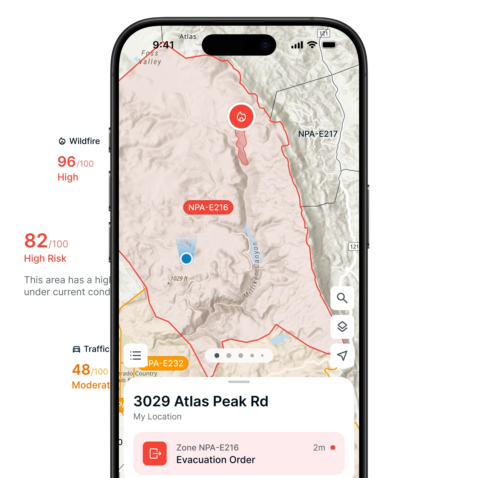
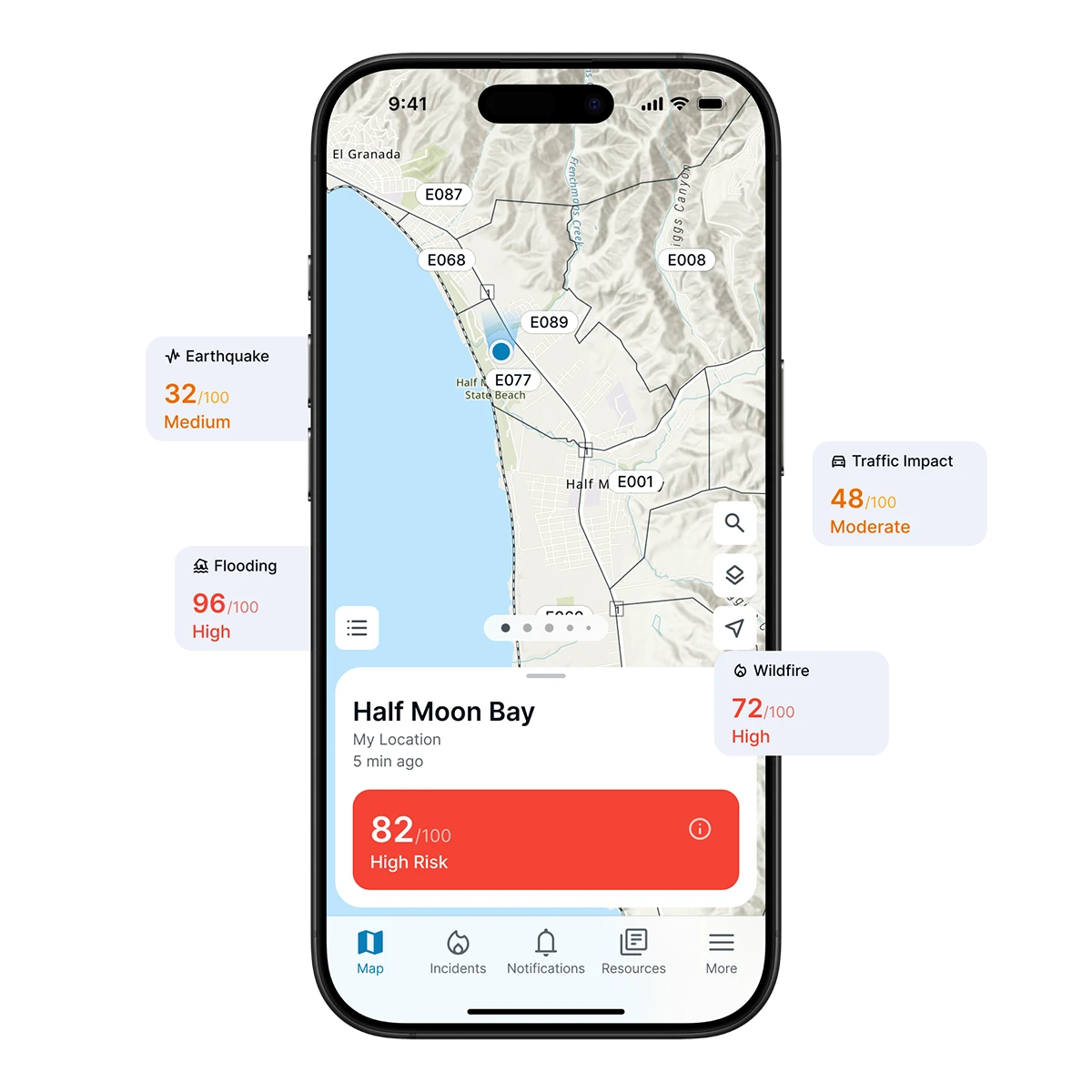
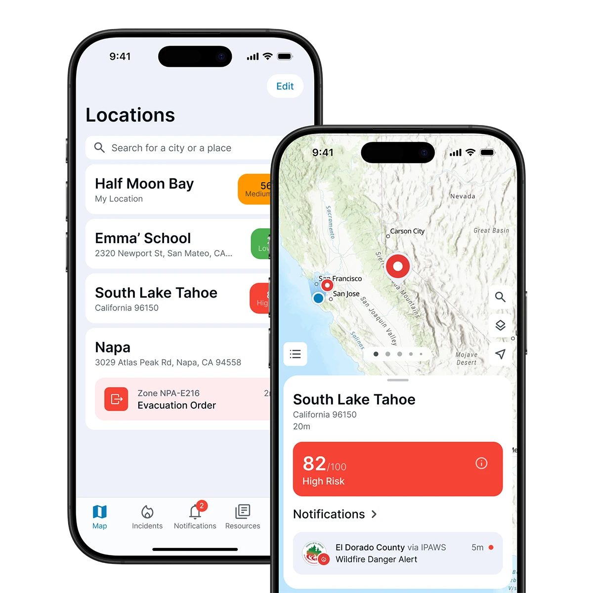
Personalized Risk Score
One score shows your changing risk from wildfire, flood and more.
Real-Time
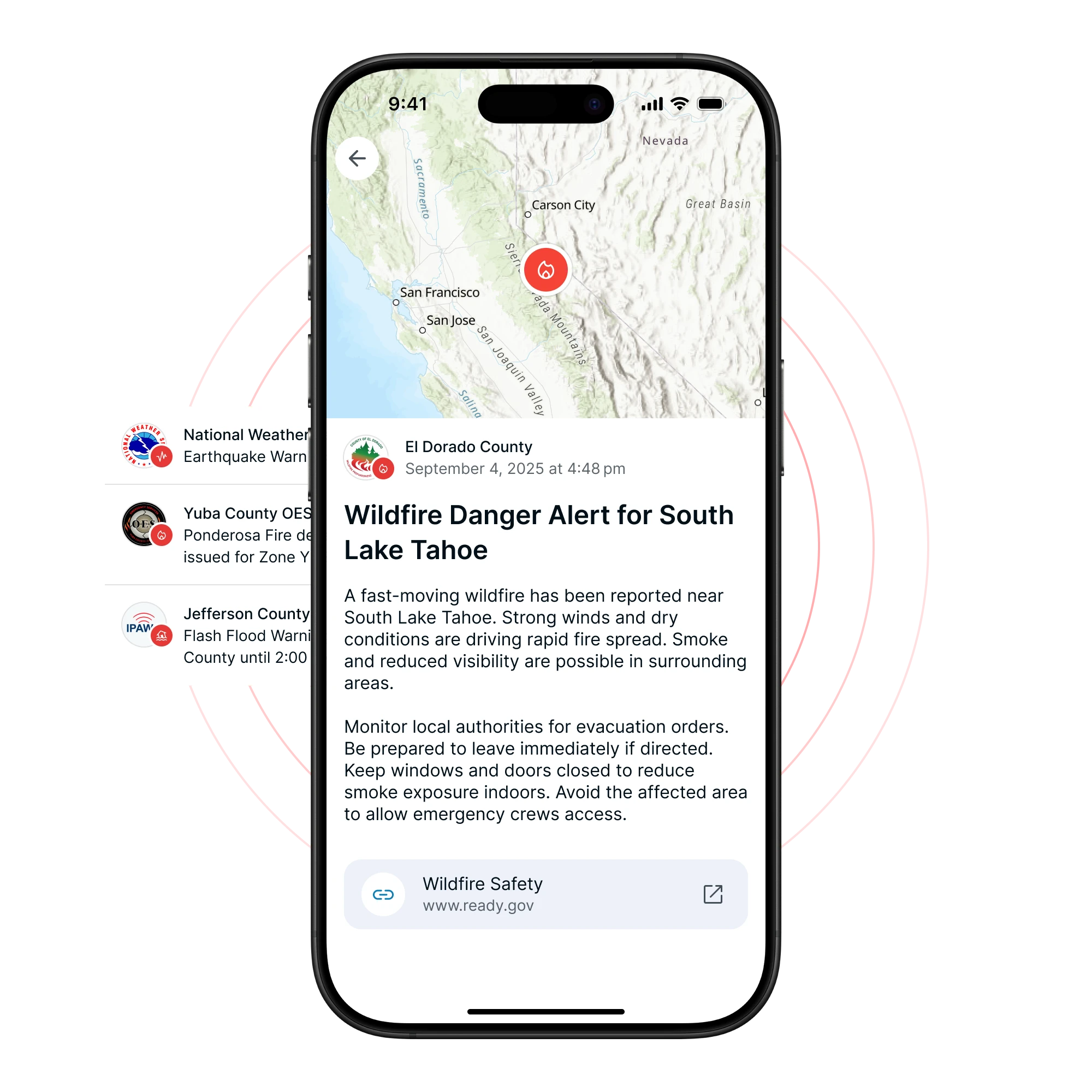
Notifications
Verified notifications when risk rises, evacuations start, or the all-clear is given.
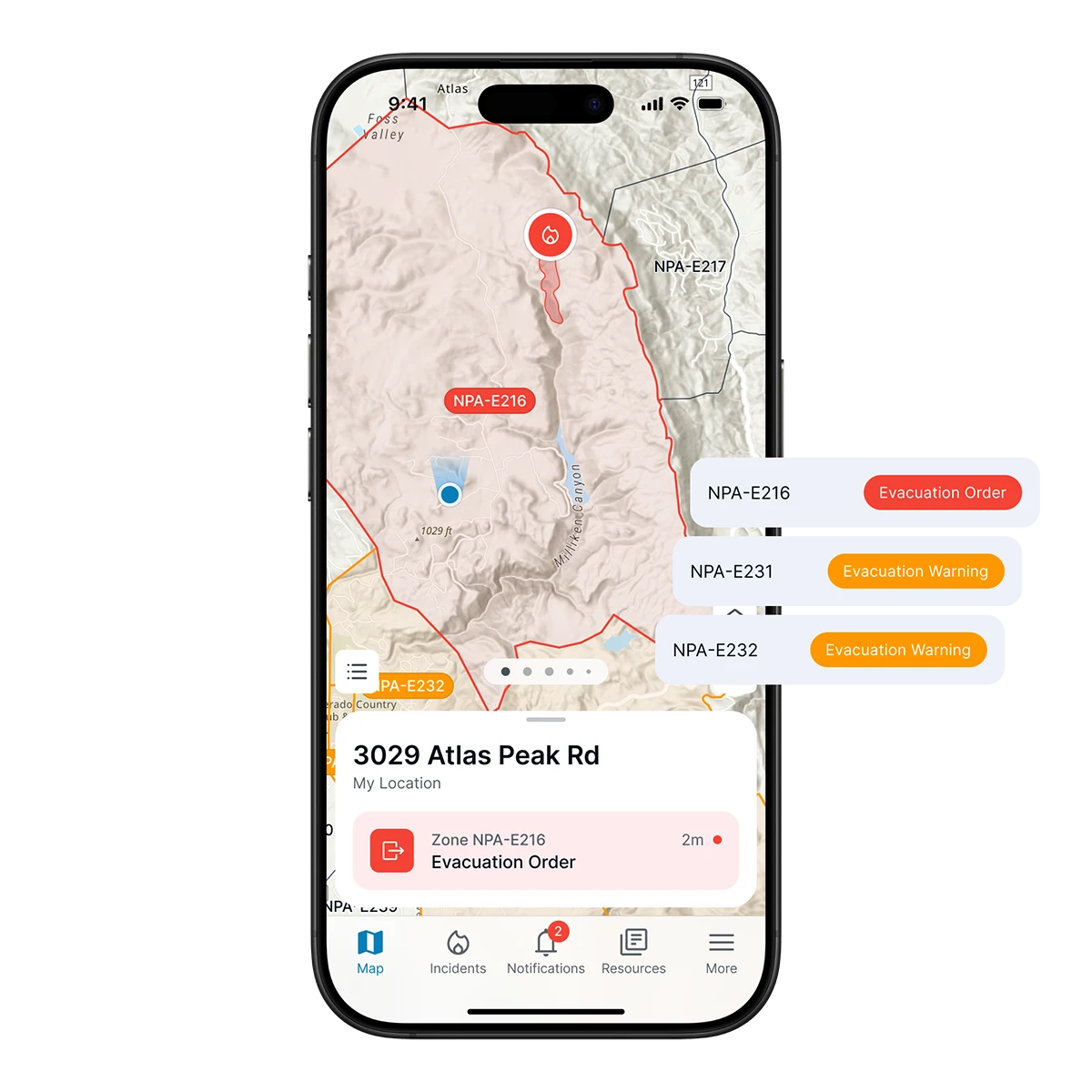
Evacuation Status
“Ready, Set, Go” guidance so you know exactly what to do next.
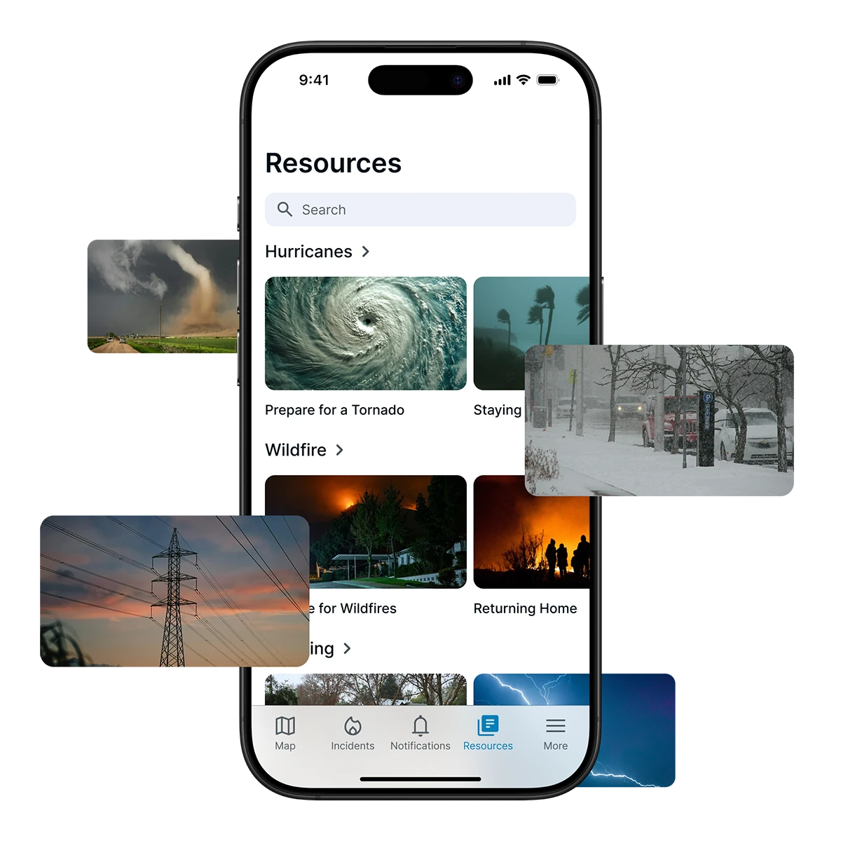
Educational Resources
Practical steps to prepare and plan before the next disaster.
Stay Safe with Sentinel
Know Your Risk, Anytime
See your personal risk score at a glance and understand what it means for your home, your family, and your neighborhood.
Act Quickly When it Counts
From sudden weather changes to evacuation orders, Sentinel ensures you get the right notifications in time to make the right decisions.
Stay Connected to Your Community
Because Sentinel is linked to local emergency managers, you receive trusted information that keeps everyone on the same page.
Be Ready Before Disaster Strikes
Use Sentinel’s preparedness tips and resources to make a plan, stay informed, and never be caught off guard when disaster strikes.
Get Sentinel
Download Sentinel for risk insights and real-time notifications.
Download App